
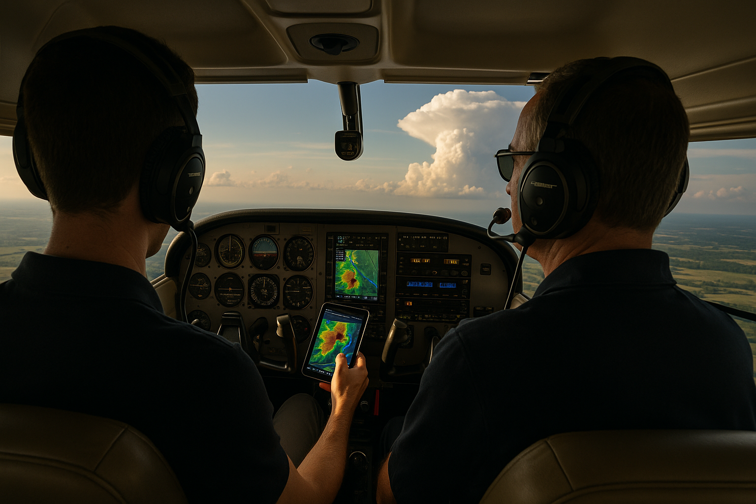
Thunderstorm avoidance is one of the most practical and unforgiving weather decision-making skills a pilot can develop. A thunderstorm is not just a rain shower with lightning. It is a convective system capable of producing severe turbulence, hail, wind shear, heavy precipitation, reduced visibility, icing in the right temperature range, rapid pressure changes, and outflow boundaries that can affect an aircraft well beyond the visible rain shaft.
For student pilots, thunderstorms often appear in training as a weather theory topic. For working pilots and active general aviation pilots, they become a real operational problem: a route that looked acceptable in the morning becomes questionable by afternoon, a line of weather develops faster than forecast, or a scattered cell appears directly over the intended destination. The goal of this article is to translate thunderstorm knowledge into real-world tactics: how to plan, how to update the plan, how to interpret weather information, when to deviate, and when to stop trying to make the flight work.
What Makes Thunderstorms Different From Ordinary Weather
Many pilots are comfortable with low ceilings, crosswinds, or moderate rain when those conditions are stable, forecast, and within the pilot’s and aircraft’s capabilities. Thunderstorms are different because they are dynamic. They build, decay, merge, split, accelerate, and generate hazards that can extend outside the area where rain is falling. A pilot who treats a thunderstorm like a localized rain shower can be surprised by conditions that change faster than the aircraft can safely escape.
At the core of thunderstorm development are three broad ingredients: moisture, unstable air, and lift. When warm, moist air rises into an unstable atmosphere, it can build vertically into a cumulonimbus cloud. As the cell matures, strong updrafts and downdrafts can exist close together. Precipitation loading, evaporative cooling, and descending air can create powerful outflows at the surface. These outflows may spread away from the storm as gust fronts, shifting winds and creating turbulence even before the storm reaches an airport.
From the cockpit, the most important point is not the meteorological definition. It is the operational behavior. Thunderstorms are three-dimensional hazards. The danger is not limited to the dark cloud base or the radar return directly ahead. The anvil may contain ice crystals and turbulence. The outflow may cross an airport while the visible storm is still several miles away. A cell may look isolated at departure and become part of a line by the time the aircraft reaches the next waypoint.
That is why successful thunderstorm avoidance begins before engine start and continues until the aircraft is tied down. The tactic that works is not bravery, optimism, or a last-minute turn. It is disciplined avoidance supported by good preflight planning, continuous weather awareness, conservative routing, and willingness to land early.
Why This Matters in Real-World Aviation
Thunderstorm decisions are rarely made in a classroom-perfect environment. Pilots are often balancing schedule pressure, passenger expectations, fuel planning, airspace constraints, terrain, daylight, and instrument currency. A flight instructor may be trying to teach a cross-country lesson without creating unnecessary fear. A business aviation crew may be coordinating with dispatch, ATC, and passengers. A private pilot may be halfway home when a convective forecast becomes reality.
The real-world challenge is that thunderstorms can tempt pilots into gradual risk acceptance. A route that was meant to remain well clear of weather slowly bends closer to a cell. A pilot accepts one small deviation, then another, until escape options narrow. A line of storms that looked broken on a screen becomes solid in the windshield. A destination remains technically VFR or above instrument minimums, but the surface winds and lightning environment make the approach and landing a poor idea.
Training should therefore treat thunderstorm avoidance as an aeronautical decision-making skill, not merely a weather recognition exercise. The pilot needs to ask practical questions: Where will the storms be when I get there? What is my escape route if they develop faster? What airports are available before the weather blocks my route? Is there daylight and fuel to wait, deviate, or return? Are my weather sources current enough for the decision I am making?
Thunderstorms also matter because the aircraft’s certification category, avionics, and pilot certificate do not make it immune to convective weather. Airborne radar, datalink weather, stormscope-type equipment, and ATC assistance can improve awareness, but none of them convert a thunderstorm into acceptable airspace. Avoidance remains the central strategy.
How Pilots Should Understand Thunderstorm Avoidance
Good thunderstorm avoidance is built around one principle: never let the storm choose your options. If the pilot waits until the aircraft is near a mature cell, the remaining choices may all be poor. If the pilot acts early, the choices are usually simpler: delay, reroute, climb or descend for smoother air outside the convective area, divert, or land and wait.
Preflight planning should start with the big picture. Look at frontal boundaries, convective outlooks, radar trends, satellite imagery, surface observations, terminal forecasts, pilot reports, and any applicable convective weather products available through approved or reliable sources. The exact products vary by country, operation, and equipment, but the concept is the same: understand the environment, not just a single airport forecast.
After the big picture, focus on timing. Thunderstorm risk is often strongly tied to time of day, local heating, boundaries, terrain effects, and the movement of weather systems. A route may be reasonable in the morning and unacceptable by late afternoon. A modest delay may improve conditions after storms move through, or it may make the situation worse by placing the aircraft in the peak convective window. The pilot’s job is not to find a forecast that permits the flight. The job is to identify the safest time, route, and go or no-go decision.
In flight, the pilot should treat weather information according to its strengths and limits. The windshield remains important. Towering cumulus, virga, dark bases, lightning, blowing dust, sharply changing visibility, or a shelf-like cloud can tell a pilot that convective activity is present or nearby. Datalink weather can show regional trends, but it is not a real-time tactical penetration tool. Airborne weather radar, where installed and properly used, can help detect precipitation intensity and structure, but it requires training, correct tilt management, and conservative interpretation. ATC can provide helpful information, workload permitting, but controllers are not responsible for making the pilot’s weather decisions.
A practical way to think about avoidance is to create personal weather margins before the flight. Those margins should consider pilot experience, aircraft capability, terrain, airspace, fuel, day or night operation, passenger comfort, and escape options. A newly certificated private pilot in a light training airplane should not use the same convective strategy as a two-pilot turbine crew with onboard radar and dispatch support. Even then, the difference is not permission to penetrate thunderstorms. It is a difference in available tools, workload capacity, and strategic flexibility.
Strategic Versus Tactical Avoidance
Thunderstorm avoidance works best when pilots separate strategic decisions from tactical decisions. Strategic avoidance happens before the aircraft is close to the weather. It includes choosing a departure time, selecting a route around convective areas, adding fuel for deviations, identifying alternates, and deciding whether the trip should be postponed. Tactical avoidance happens in flight when the pilot must adjust to actual weather development.
Strategic decisions are usually safer because they are made with lower workload and more options. A pilot sitting at a desk can compare routes, review multiple weather products, call a briefer if available, and discuss the plan with an instructor, dispatcher, or another pilot. A pilot in the cockpit near convective weather has less time, higher workload, and more pressure. That is why a good strategic plan should include trigger points. For example, the pilot may decide before departure that if the line of storms reaches a certain waypoint before the aircraft does, the flight will stop short at a planned airport.
Tactical decisions are still necessary because thunderstorms are imperfectly forecast. The key is to make tactical decisions early. If the aircraft is approaching a building cell, a 20-degree heading change made early may preserve options. Waiting until the weather is close may require a large deviation, an urgent turn, or a diversion into a busy or unfamiliar airport. Early deviations are usually smoother, more comfortable, and safer than dramatic last-minute escapes.
For VFR pilots, tactical avoidance also means protecting visual reference. Never let a deviation place the aircraft into lowering ceilings, poor visibility, rising terrain, or a narrowing valley of airspace simply to remain clear of one cell. For IFR pilots, tactical avoidance means coordinating with ATC early, requesting deviations before the route is blocked, and refusing clearances that would place the aircraft too close to convective weather. An IFR clearance is not a weather clearance. The pilot in command remains responsible for the safe operation of the aircraft.
Using Weather Tools Without Being Fooled by Them
Modern cockpit weather tools are valuable, but they can create a false sense of precision. A colorful weather image on a panel or tablet can make the atmosphere appear more orderly than it is. Pilots must understand what each tool shows, how current it is, and how it can mislead.
Datalink radar imagery is excellent for strategic awareness. It helps pilots see where precipitation has been detected, how lines are moving, and whether a route is becoming blocked. However, the displayed image may be delayed by processing, transmission, and display update cycles. The age shown on the display may not represent the age of every part of the mosaic in the way a pilot intuitively expects. For that reason, datalink radar should not be used to thread between closely spaced convective cells at short range.
Airborne radar, when installed, has different strengths and limitations. It can provide more immediate information ahead of the aircraft, but it primarily detects precipitation and requires correct operation. Radar tilt, attenuation, beam width, precipitation type, and range selection all affect interpretation. A weak-looking area behind intense precipitation may be a shadowed region rather than a safe gap. Pilots should receive aircraft-specific training before relying on airborne radar for convective avoidance.
Lightning information, whether from ground-based networks or onboard systems, can help identify electrical activity and convective intensity. But absence of displayed lightning does not guarantee absence of hazardous turbulence, heavy rain, or developing convection. Satellite imagery can reveal cloud tops and growth trends, but it is part of the larger weather picture, not a standalone clearance to continue.
ATC weather advisories can be useful, especially for traffic coordination during deviations. Controllers may be able to describe areas of precipitation or help with headings around displayed weather. Still, ATC radar weather depictions and cockpit weather depictions may differ in resolution, update rate, and purpose. The pilot should use ATC as a resource, not as the final authority on whether a cell is safe to approach.
Real-World Thunderstorm Avoidance Tactics
The tactics that work in the real world are usually simple, but they require discipline. First, build extra time into the flight. Thunderstorm days are poor days for tight schedules. If the route requires threading gaps, arriving exactly before a line arrives, or counting on a forecast improvement that has not started, the plan is fragile.
Second, carry enough fuel to make weather decisions without desperation. Fuel does not make weather safer, but it buys time and options. A pilot with comfortable reserves can hold outside an area, divert to a better airport, or return to the departure point. A pilot who is fuel-constrained may be tempted to continue toward a deteriorating destination.
Third, choose routes with escape options. A straight line through sparse airport coverage, high terrain, restricted airspace, or poor communications may become a trap if convection develops. A slightly longer route over more airports and lower terrain may be the safer operational choice. This is especially important for VFR pilots and pilots operating aircraft with limited climb performance.
Fourth, avoid relying on narrow gaps between storms. Gaps can close quickly, and the air between cells may contain turbulence, wind shear, heavy rain, or rapidly developing cloud. If a route depends on a gap remaining open, consider whether there is enough room to turn around, whether the gap is widening or narrowing, and whether another safer option exists. A conservative pilot treats narrow convective gaps with suspicion.
Fifth, respect storm outflow. A gust front can arrive before the rain and can shift winds rapidly at an airport. On approach, this may appear as changing airspeed, unexpected sink, turbulence, or a sudden tailwind component. On takeoff, it can create performance and control challenges. If lightning, blowing dust, strong gusts, or rapidly shifting winds are present near the airport, waiting on the ground is usually the better training and operational decision.
Finally, use diversion as a normal tool, not as a failure. Diverting for convective weather is a sign that the pilot is managing risk appropriately. The best diversion is often made before the situation feels urgent. A stop for fuel, food, and updated weather can turn a marginal flight into a routine one.
Common Mistakes and Misunderstandings
One common mistake is treating the absence of rain at the aircraft as evidence that the aircraft is not affected by the storm. Thunderstorm hazards can extend outside the visible precipitation area. Turbulence, outflow, and wind shifts may occur where the sky is not yet dark or where rain is not falling.
Another mistake is focusing on the destination while ignoring the route. A pilot may see that the departure and destination are both reporting acceptable conditions, but the route between them may be blocked by convective activity. This is especially risky when the flight crosses areas with limited alternates or when the pilot has not planned a practical midpoint diversion.
A third misunderstanding is assuming that an instrument rating makes thunderstorm flying manageable. Instrument skills help a pilot operate in clouds and reduced visibility when conditions are within safe and legal limits. They do not make convective turbulence, hail, severe precipitation, or wind shear acceptable. In fact, entering a thunderstorm in instrument conditions may remove visual cues and increase workload at the worst possible time.
Pilots also get into trouble by using old weather information for a new decision. A preflight briefing from two hours ago may no longer reflect a rapidly changing convective environment. In flight, a radar image that appears manageable may represent where the weather was, not where the strongest part of the storm is now. Updating weather is not a paperwork exercise. It is part of active risk management.
Passenger pressure is another subtle hazard. Pilots often feel responsible for completing the trip, especially when passengers do not understand why a flight should stop when the destination appears nearby. The solution is to brief passengers early. Explain that thunderstorm days require flexibility and that a diversion or delay is part of safe aviation decision-making. A pilot who sets expectations before departure is less likely to feel trapped by them in flight.
Practical Example: A Summer Cross-Country With Building Cells
Consider a private pilot planning a 220-nautical-mile VFR cross-country in a four-seat single-engine airplane on a summer afternoon. The departure airport is clear, the destination is VFR, and the initial route looks open. The weather briefing shows a chance of afternoon thunderstorms along a weak boundary near the middle of the route. Radar shows only a few small returns at the time of planning.
A weak plan would be to depart immediately, watch the tablet, and hope the cells remain isolated. A better plan starts by asking what the route will look like in two hours. The pilot compares the timing of convective development with the expected arrival at the boundary, identifies two airports before the weather area, and adds fuel to allow for a diversion. The pilot also decides that if cells begin forming along the route before reaching the first planned checkpoint, the flight will land short and wait.
After departure, the pilot sees towering cumulus developing ahead and notices the datalink image filling in near the planned course. Rather than continuing until the route is blocked, the pilot turns toward the first planned airport while conditions remain good. On the ground, the pilot checks updated weather and sees that the scattered cells have become a more organized area of thunderstorms. The destination remains technically VFR, but the route is no longer reasonable. The pilot waits until the convective activity moves east and the route opens behind it, or decides to complete the trip the next morning.
This scenario is not dramatic, and that is the point. The safest thunderstorm decisions often look uneventful because the pilot acted before the situation became dramatic. The aircraft never entered heavy precipitation. ATC did not need to issue urgent vectors. Passengers were inconvenienced, not frightened. The pilot used planning, timing, fuel, and discipline to keep the thunderstorm from dictating the outcome.
Best Practices for Pilots
Best practices for thunderstorm avoidance begin with humility. Convective weather is stronger than the airplane, faster-changing than many pilots expect, and capable of creating hazards outside the obvious cloud. The safest pilots do not try to prove that a storm can be outsmarted at close range. They plan to remain well away from it.
Before departure, review more than one type of weather information when available. Look for agreement or disagreement between forecasts, radar trends, satellite imagery, observations, and pilot reports. Pay special attention to timing and movement. If thunderstorms are forecast, identify what will cause you to delay, cancel, reroute, or divert. Write down or verbalize those triggers so they are not renegotiated under pressure.
In flight, keep updating the mental picture. Is the weather building faster than expected? Are tops rising? Is visibility decreasing ahead? Are other aircraft asking for deviations? Is ATC workload increasing? Are airports behind you still available? The earlier you notice a trend, the easier it is to make a conservative decision.
Use clear communication. If you need a deviation, ask early and state your intent plainly. If you are VFR and need to turn around or divert, make the decision while you still have good visibility and terrain clearance. If you are IFR, coordinate with ATC but do not accept a heading or altitude that places the aircraft into unacceptable weather. If necessary, declare your intentions and exercise pilot-in-command authority.
The following habits are especially useful on convective weather days:
- Plan routes that preserve airports, fuel, daylight, and airspace options.
- Use datalink weather for strategic awareness, not close-range storm threading.
- Make deviations early, before the aircraft is boxed in by cells, terrain, or controlled airspace.
- Brief passengers that thunderstorm delays and diversions are normal safety decisions.
- Be willing to stop short when the next segment is no longer clearly safe.
Flight instructors should teach thunderstorm avoidance as scenario-based decision-making. Instead of asking only what a cumulonimbus cloud is, ask what the student would do if a line develops across the route, if the destination reports gusty outflow winds, or if a tablet radar image shows a tempting gap. The best training outcome is not memorization. It is a pilot who recognizes deteriorating options early and acts without embarrassment.
Frequently Asked Questions
Can pilots fly through a thunderstorm if the aircraft is IFR-equipped?
No prudent pilot should treat IFR equipment or an instrument rating as permission to fly through a thunderstorm. IFR capability helps with navigation and control in instrument meteorological conditions, but convective hazards such as severe turbulence, hail, wind shear, and intense precipitation require avoidance rather than penetration.
Is datalink weather accurate enough for thunderstorm avoidance?
Datalink weather is valuable for strategic planning and broad situational awareness, but it should not be used as a real-time tool to weave between nearby thunderstorm cells. The displayed image may not represent the current position or intensity of fast-changing convective weather.
How far should pilots stay from thunderstorms?
Pilots should give thunderstorms wide margins, especially around intense cells, fast-moving lines, and storms with visible anvils or significant lightning. Specific distance guidance can vary by training source, aircraft, operation, and weather intensity, so pilots should use conservative margins and follow applicable procedures or instructor guidance.
What should a VFR pilot do if thunderstorms begin forming along the route?
A VFR pilot should act early while visibility, terrain clearance, and airport options remain good. The safest choice may be to turn around, divert to a nearby airport, land and wait, or choose a different route that remains clearly free of convective weather.
Can ATC keep an aircraft clear of thunderstorms?
ATC can provide helpful information and may assist with deviations, but the pilot remains responsible for weather avoidance and aircraft safety. Controllers may have workload limits and different weather displays than the pilot, so ATC assistance should supplement, not replace, pilot judgment.
What is the biggest training lesson for thunderstorm avoidance?
The biggest lesson is to make conservative decisions early. Thunderstorm encounters usually become dangerous when pilots continue too long, accept narrowing options, or rely on technology to solve a problem that should have been avoided strategically.
Key Takeaways
- Thunderstorm avoidance is primarily a decision-making discipline: plan early, update often, and keep wide margins from convective weather.
- Modern weather tools improve awareness, but they do not make close-range storm threading safe or eliminate the need for visual judgment and conservative routing.
- Diversions, delays, and cancellations are normal professional responses to thunderstorms, not signs of poor piloting or weak flight planning.