Terrain risk planning is one of the most practical safety skills a pilot can develop, because terrain does not have to be mountainous to become a serious flight hazard. Rising ground, towers, ridgelines, valleys, night conditions, low ceilings, haze, precipitation, unfamiliar geography, and aircraft performance limitations can all turn an otherwise routine route into a demanding aeronautical decision-making problem.
For student pilots, evaluating terrain along a route builds disciplined preflight habits. For flight instructors, it creates teachable moments about chart interpretation, altitude selection, weather judgment, and diversion planning. For experienced pilots, it is a reminder that automation, GPS direct routing, and familiarity can reduce workload only when they are backed by sound terrain awareness. The goal is not simply to avoid hitting terrain. The goal is to maintain enough altitude, visibility, performance margin, and decision time that terrain never becomes the controlling factor in the flight.
What Terrain Risk Means in Route Planning
Terrain risk is the possibility that natural terrain or man-made obstacles along a route could reduce safety margins, limit escape options, or increase pilot workload. It includes obvious hazards such as mountains and ridges, but it also includes less dramatic features such as rolling terrain beneath a lowering ceiling, antenna farms near a night VFR route, or a valley route with limited turning room.
A good route evaluation considers more than the highest elevation printed near a course line. Pilots should look at how terrain changes along the route, where the ground rises unexpectedly, what obstacles are near the intended flight path, and how weather could reduce usable altitude. A route that looks comfortable in clear daylight may become unacceptable at night, in marginal visibility, or with a strong headwind that reduces climb performance after departure.
Terrain risk also depends on the aircraft and the operation. A high-performance aircraft with strong climb capability may have more options than a heavily loaded trainer on a hot afternoon. An IFR flight operating on a published route may have different protections than a VFR flight following a GPS course across sparsely populated terrain. A pilot who knows the area well may recognize drainage patterns, ridge lines, and safe valleys, while a visiting pilot may see only a screen full of magenta lines and shaded relief.
The most important concept is margin. Terrain planning is not about finding the lowest altitude that might work. It is about selecting a route and altitude that provide a comfortable buffer above terrain and obstacles while preserving legal compliance, weather clearance, aircraft performance, communications, navigation reception, and diversion options.
Start With the Big Picture Before Drawing the Line
Many terrain-related planning problems begin when the pilot starts with a direct course and then tries to make the terrain fit the route. A better method is to first study the geography. Before committing to a line on a chart, identify the major terrain systems between departure and destination. Look for mountain ranges, plateaus, escarpments, valleys, passes, water crossings, and large areas with sparse emergency landing options.
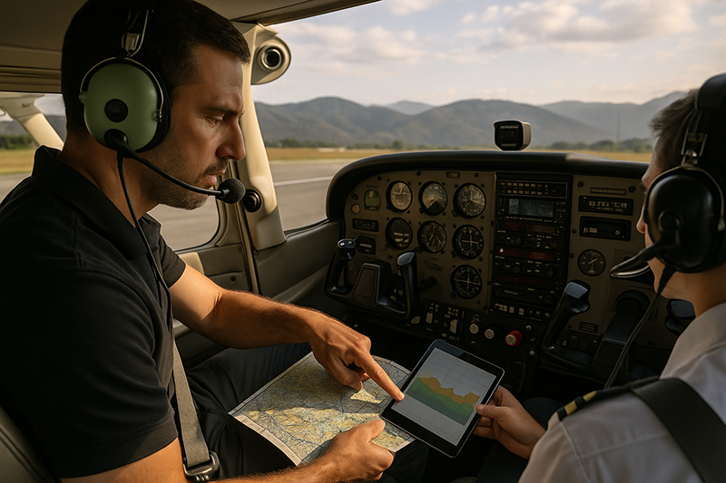
On visual charts, terrain tinting, contour information, spot elevations, maximum elevation figures, obstacle symbols, and airport elevations help build a three-dimensional mental picture. Digital applications can make this easier with profile views and terrain shading, but the pilot still needs to interpret what the information means. A terrain profile is not a go or no-go decision by itself. It is a prompt to ask better questions: Where is the highest ground? Where would I cross it? How much clearance do I want? What if the ceiling lowers? What if the winds aloft are stronger than forecast? What if I need to turn around?
For IFR pilots, published routes, minimum en route altitudes, minimum obstruction clearance altitudes, off-route obstruction clearance altitudes, minimum sector altitudes, and approach procedure altitudes provide important planning information. These published values must be understood in context. A published altitude may apply only to a specific route segment, airway, fix, sector, or procedure area. It does not automatically protect a pilot who is off route, descending early, accepting a visual clearance in marginal conditions, or navigating outside the protected area.
For VFR pilots, the planning challenge is often more flexible but also less structured. A VFR pilot may choose a valley route, follow lower terrain, or delay departure for better visibility. That flexibility is valuable, but it places more responsibility on the pilot to maintain terrain clearance, weather clearance, and a continuous escape plan. VFR into deteriorating weather near rising terrain is especially unforgiving because the usable vertical and horizontal space can shrink quickly.
Why This Matters in Real-World Aviation
Terrain risk is not limited to remote mountain operations. It appears in training flights, cross-country planning, aerial survey, air ambulance staging, night operations, scenic flights, business aviation, ferry flights, and routine personal transportation. Any time a pilot flies near higher terrain, over unfamiliar country, at night, in reduced visibility, or near obstacles, terrain evaluation becomes part of the safety picture.
One practical concern is controlled flight into terrain, often abbreviated CFIT. This describes an airworthy aircraft under pilot control that is unintentionally flown into terrain, water, or an obstacle. The phrase is familiar because it captures a sobering reality: the airplane may be functioning normally, but the crew’s terrain awareness, altitude management, navigation, or decision-making has failed. Modern avionics can help, but they do not eliminate the need for disciplined planning and situational awareness.
Terrain also affects weather decisions. Wind interacting with ridges can produce turbulence, downdrafts, mountain wave activity, rotor conditions, and rapidly changing cloud patterns. A route through lower terrain may look attractive, but if it funnels wind or limits maneuvering room, it may not be the safest choice. A route over higher terrain may provide better navigation and communication reception but require more altitude, more oxygen planning where applicable, and more attention to aircraft performance.
Aircraft performance is another real-world factor. Climb rate, service ceiling, weight, temperature, runway elevation, and density altitude all matter when terrain lies ahead. A pilot should not assume that reaching a planned cruise altitude will be easy simply because the altitude appears in a navigation log. The climb must happen at the time and location needed, with the actual aircraft loading, engine performance, wind, and temperature. If the aircraft cannot comfortably reach or maintain an altitude that provides the desired terrain clearance, the correct answer may be a different route, a different time of day, a fuel stop, a reduced load, or no flight.
How Pilots Should Understand Terrain Information
Terrain information comes from multiple sources, and each source answers a different question. A chart helps identify elevations, obstacles, routes, airports, and airspace. A digital profile view shows how a planned altitude compares with terrain along a course. A performance chart or aircraft flight manual helps determine whether the airplane can climb as planned. Weather products help assess cloud bases, visibility, winds, turbulence, icing potential, and convective hazards. Pilot reports and local knowledge may add valuable operational context.
The key is to combine these sources rather than treating any single display as complete. A moving map may show terrain in green, yellow, and red, but color shading is not a substitute for altitude planning. A chart may show a maximum elevation figure for a quadrangle, but that does not mean every obstacle is located directly under the route, nor does it guarantee that a pilot can safely fly at that altitude in the presence of weather, turbulence, or navigation uncertainty. A published IFR altitude may provide obstacle clearance within its protected area, but the pilot must remain within the assumptions of that procedure or route.
When evaluating a route, pilots should think in layers. The first layer is geography: where the terrain rises, where the valleys run, and where the obstacles are concentrated. The second layer is altitude: what altitude provides the desired clearance and whether that altitude is compatible with airspace, weather, aircraft performance, oxygen considerations, and passenger comfort. The third layer is time: when the airplane will reach each area, when the terrain begins to rise, and whether there is enough distance to climb before the critical terrain point. The fourth layer is escape: where the pilot can turn, divert, descend safely, land, or reverse course if conditions change.
That last layer is often overlooked. A route that offers only one narrow path through terrain can become high risk if weather lowers, turbulence increases, or the aircraft fails to climb as expected. A slightly longer route with more airports, lower terrain, better communications, and wider valleys may be the better aviation decision. Good terrain planning is not always the shortest route. It is the route that preserves options.
Evaluating VFR Terrain Risk
VFR terrain planning begins with visibility and cloud clearance, but it should not end there. Legal VFR conditions do not automatically mean comfortable or safe terrain clearance for every pilot, aircraft, and route. A VFR pilot flying near rising terrain must maintain enough visibility to identify terrain, remain oriented, avoid obstacles, and maneuver without being forced into a climb, descent, or turn that the aircraft or pilot cannot safely manage.
Night VFR deserves special caution. Terrain that is visually obvious in daylight can disappear into darkness, especially in sparsely lit areas. A black ridgeline ahead may not be visible until it is too late to make a comfortable correction. City lights can create the impression of level terrain while higher ground surrounds the route. Over remote areas, the absence of lights can make horizon detection and distance judgment more difficult. For night operations, many pilots choose higher altitudes, more conservative routes, and stronger reliance on instrument cross-check and terrain-aware planning.
Valley flying is another area where VFR pilots need judgment. Valleys may provide lower terrain routes, but they can also restrict turning radius, funnel wind, hide wires, and lead toward rising ground. A valley route should be evaluated for width, slope, wind, escape routes, and visibility around bends. If the valley narrows or rises faster than expected, the pilot should have already decided where to turn around or divert. The time to discover that a canyon is too tight is not after the aircraft is committed deep inside it.
VFR pilots should also consider emergency landing options. Terrain clearance is not only about avoiding impact in normal flight. It is also about what happens after an engine problem, electrical failure, smoke event, passenger issue, or weather diversion. Flying over lower terrain with more airports and fields may reduce risk even if it adds time. When terrain is rugged or heavily forested, the pilot should account for fewer forced-landing options and greater rescue complexity.
Evaluating IFR Terrain Risk
IFR procedures and routes provide important structure, but instrument pilots still need to understand terrain risk. Published instrument routes and procedures are designed with obstacle clearance criteria, but those criteria depend on the pilot flying the correct route, maintaining the required altitudes, using appropriate navigation sources, and respecting procedure boundaries. Terrain risk can increase when pilots are cleared direct to fixes, are vectored near mountainous areas, descend early, or cancel IFR before they have a reliable visual path to the airport.
One common misunderstanding is assuming that being in radar contact means terrain clearance is no longer a pilot concern. Air traffic control provides valuable services, but the pilot remains responsible for complying with clearances, maintaining assigned altitudes, and refusing or questioning a clearance that appears unsafe or unclear. In mountainous or remote areas, radar coverage and communications may be limited. Even when ATC services are available, situational awareness belongs in the cockpit.
IFR pilots should compare direct routings with published airway or procedure options. A direct route may be legal and efficient in some circumstances, but it may cross higher terrain, reduce navigation redundancy, or place the airplane in an area where an engine or equipment problem would leave fewer options. Published routes may appear less direct, but they often follow corridors that support navigation, communication, and obstacle clearance planning.
Descent planning is especially important. Many terrain events are not caused by cruise altitude decisions but by premature descent, unstable visual maneuvering, or misunderstanding where the aircraft is relative to the protected segment of a procedure. A conservative instrument pilot remains disciplined about minimum altitudes, verifies fixes and distances, and avoids descending below appropriate altitudes until the aircraft is in a position where a safe landing or continued procedure is assured.
Weather, Visibility, and Terrain Are One Decision
Terrain and weather cannot be separated. A mountain ridge that is safely crossed on a clear day can become a barrier when cloud bases lower. A route with generous terrain clearance can become uncomfortable if strong winds create downdrafts near the crossing point. A familiar valley can become confusing in smoke, haze, precipitation, or snow cover. Weather reduces not only visibility but also time, options, and confidence.
Ceiling matters because it determines how much usable vertical space exists between the clouds and the terrain. Visibility matters because it determines how early the pilot can see terrain, obstacles, and escape routes. Wind matters because it can affect groundspeed, climb gradient, turbulence, and the ability to outclimb rising terrain. Temperature matters because it affects density altitude and aircraft performance. Icing potential matters because an aircraft that accumulates ice may lose climb performance and controllability margin while operating near terrain.
When terrain is involved, a forecast should not be treated as a single yes or no product. Pilots should look for trends, regional differences, freezing levels where applicable, cloud layers, winds aloft, and reports from nearby airports. A destination airport may report acceptable conditions while the route across higher terrain is obscured. A departure airport may be clear while a pass or ridge crossing is hidden in cloud. A route that depends on one specific gap in the weather is inherently more fragile than a route with multiple alternatives.
Good terrain-weather planning includes personal minimums. These minimums should account for pilot experience, aircraft capability, avionics, daylight, route familiarity, and passenger pressure. A newly certificated pilot in a basic trainer should not apply the same comfort threshold as a highly experienced mountain instructor in an appropriately equipped aircraft. Conservative judgment is not a lack of skill. It is a recognition that terrain reduces the margin for error.
Common Mistakes and Misunderstandings
One of the most common mistakes is allowing GPS direct routing to replace route analysis. The direct line may cross ridges, towers, restricted maneuvering areas, or high terrain that could easily be avoided with a modest course change. The magenta line is a navigation reference, not a safety endorsement.
Another mistake is focusing only on the highest terrain point and ignoring the climb needed to get there. A planned cruise altitude may clear the ridge, but if the aircraft reaches that ridge before reaching the altitude, the plan fails. Pilots should compare climb performance with distance available, winds, temperature, aircraft weight, and the location of rising terrain. This is especially important after departure from airports surrounded by hills or mountains.
Some pilots also misuse chart elevations. A maximum elevation figure gives useful information for a charted area, but it should not be interpreted as a precise route clearance altitude for every situation. Obstacle data, terrain data, chart currency, navigation accuracy, altimeter setting, and pilot technique all matter. Pilots should build a reasonable buffer above published terrain and obstacle information rather than flying close to the numbers.
A related misunderstanding is assuming that terrain awareness equipment will always provide enough warning. Terrain alerting systems, moving maps, and synthetic vision can be excellent tools, but they depend on databases, settings, aircraft position, pilot attention, and correct interpretation. Alerts can occur late in rapidly changing flight paths, and nuisance alerts can tempt pilots to ignore them. Technology should confirm a safe plan, not rescue a poor one.
Finally, pilots sometimes underestimate the human factors of terrain flying. Rising ground can create subtle pressure to continue climbing even when aircraft performance is marginal. A lowering ceiling can make a pilot descend toward terrain while trying to remain visual. Passenger expectations can make a diversion feel inconvenient. Familiarity can lead to complacency. The disciplined pilot recognizes these pressures early and makes conservative choices before the options narrow.
Practical Example: Reworking a Route Around Rising Terrain
Consider a pilot planning a daytime VFR cross-country in a normally aspirated single-engine training aircraft. The departure airport is in relatively low terrain, the destination lies beyond a range of hills, and the direct course crosses a ridgeline with several towers nearby. The weather is forecast to be VFR, but cloud bases may lower during the afternoon. Winds aloft are stronger near the ridge than at the departure airport, and the temperature is warm enough to make climb performance worth checking carefully.
A weak plan would be to draw the direct line, choose a cruise altitude that appears to clear the terrain, and launch with the expectation that the airplane will climb as usual. A stronger plan begins with the terrain. The pilot studies the chart and identifies that the direct route crosses the highest portion of the ridge. A slightly longer route follows a valley to a lower crossing point, keeps the aircraft closer to two usable airports, and avoids the cluster of towers. The pilot then checks aircraft performance for the actual loading and temperature, verifies that the planned altitude can be reached well before the ridge, and identifies a point before the terrain where the flight will turn back or divert if the airplane is not at the expected altitude.
During preflight, the pilot also reviews weather along the route, not just at the endpoints. If ceilings trend lower, the valley route may still be acceptable for a while, but only if visibility remains strong and there is room to turn around. The pilot briefs passengers that the route may change or the flight may stop short if weather or performance does not match the plan. This reduces pressure in the cockpit later.
In flight, the pilot monitors climb rate, groundspeed, outside visibility, and cloud clearance. At the decision point, the aircraft is slightly lower than planned and the ridge area looks hazier than expected. Because the pilot created a decision point in advance, the response is simple: turn toward the alternate airport while options are still plentiful. The flight may be delayed, but the pilot has avoided the classic trap of pressing deeper into rising terrain while hoping conditions improve.
Best Practices for Pilots
Effective terrain risk planning is a habit, not a special procedure reserved for mountain trips. Even over modest terrain, pilots benefit from a consistent approach that connects chart reading, performance planning, weather interpretation, and decision-making.
- Build the route around terrain, not just distance. Evaluate ridges, valleys, obstacles, airports, and emergency landing areas before accepting a direct course.
- Use multiple information sources. Compare paper or digital charts, terrain profiles, weather, aircraft performance data, and current operational information.
- Plan climb and descent points. Know where the aircraft must be at a safe altitude and where descent can begin without compromising terrain clearance.
- Create decision points before terrain narrows your options. Decide in advance where to turn around, divert, climb, or delay if conditions do not meet the plan.
- Respect night and marginal weather. Darkness, haze, low ceilings, precipitation, and snow cover can make terrain harder to detect and easier to misjudge.
- Keep automation in perspective. Moving maps and terrain alerts are valuable, but they do not replace pilot judgment or preflight planning.
- Brief passengers and other crewmembers. A short explanation that route changes are normal safety decisions can reduce external pressure during the flight.
Instructors can strengthen this skill by asking students to defend their route choices. Instead of simply checking that the navigation log is complete, ask why a particular altitude was selected, what terrain controls the route, where the escape options are, and what would trigger a diversion. These questions develop the kind of practical judgment that pilots need after training, when the route is unfamiliar and the weather is imperfect.
Training Terrain Awareness Without Creating Fear
Terrain awareness should make pilots more capable, not more anxious. The purpose of training is to replace vague concern with specific analysis. A pilot who understands the terrain, weather, aircraft, and route options can make calm decisions. A pilot who has only been told that mountains are dangerous may either avoid valuable training opportunities or underestimate the hazard when terrain looks less dramatic.
Good instruction starts with local examples. Every training area has terrain features that can be used to teach altitude selection and situational awareness. In flatter regions, towers, wind turbines, river valleys, and subtle elevation changes can still support useful discussions. In hilly or mountainous regions, instructors can demonstrate how terrain changes the apparent horizon, affects wind and turbulence, and influences route selection.
Scenario-based training is especially effective. A student might plan a route across rising terrain, then receive a weather update that lowers ceilings along the original route. The lesson is not merely to recalculate fuel or change a waypoint. The lesson is to recognize how the new weather changes the terrain margins and to choose a safer alternative before the flight becomes pressured.
Instrument training also benefits from terrain-focused scenarios. Students should understand how minimum altitudes, step-down fixes, approach segments, missed approach procedures, and circling limitations relate to obstacle clearance. They should also practice questioning clearances or routes that do not make sense. Professional cockpit discipline includes the ability to ask for clarification, request a different altitude, or decline a clearance if safety is in doubt.
Frequently Asked Questions
What is the first step in evaluating terrain risk along a route?
Start by studying the geography before accepting a direct course. Identify the highest terrain, ridgelines, valleys, major obstacles, airports, and possible escape routes. Once the terrain picture is clear, choose an altitude and route that provide practical margins for the aircraft, weather, and pilot experience.
Is GPS terrain shading enough for safe terrain planning?
No. Terrain shading is a helpful awareness tool, but it should not be the only planning method. Pilots should also review aeronautical charts, obstacle information, aircraft performance, weather, and applicable route or procedure altitudes. Technology should support the plan rather than replace analysis.
How should pilots handle terrain risk during night VFR?
Night VFR near terrain calls for conservative altitude selection, careful route planning, reliable instrument cross-check, and strong awareness of obstacles and lighting illusions. If terrain cannot be clearly identified visually, the pilot should rely on preplanned safe altitudes and avoid routes that leave little room for error.
Do IFR routes eliminate terrain risk?
Published IFR routes and procedures can provide important obstacle clearance when flown correctly, but they do not eliminate the need for pilot awareness. Terrain risk can increase with off-route direct clearances, early descents, visual maneuvering in marginal conditions, or misunderstanding the protected area of a procedure.
When should a pilot choose a longer route to reduce terrain risk?
A longer route may be safer when it follows lower terrain, provides better airports and emergency landing options, improves communications, avoids obstacles, or offers more room to turn around. The safest route is often the one that preserves options, not necessarily the one with the shortest distance.
Key Takeaways
- Evaluate terrain risk by combining chart interpretation, aircraft performance, weather, altitude planning, and escape options.
- Do not let GPS direct routing, terrain displays, or routine familiarity replace disciplined preflight analysis.
- Use conservative decision points before entering rising terrain, marginal weather, narrow valleys, or night operations with limited visual references.