
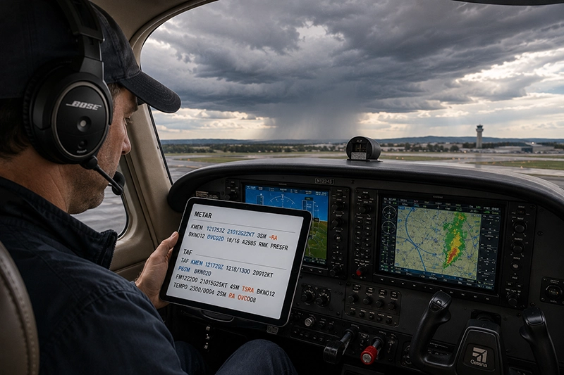
METARs and TAFs are the foundation of preflight weather briefings and in-flight weather awareness for pilots. Learning to read METARs and TAFs like a pro turns compact coded messages into clear operational information that improves decision-making, fuel planning, go/no-go choices, and safety margins. Whether you are a student pilot mastering weather basics or an instrument-rated pilot refining approach briefing skills, accurate interpretation of these reports is essential.
This article explains what METARs and TAFs contain, how to decode the most important elements, and how to use their information in everyday flight operations. You will find practical examples, common mistakes to avoid, operational takeaways, and a concise FAQ to reinforce the key points. The goal is not to memorize every code but to develop the judgment to convert coded weather into useful flight decisions.
What Are METARs and TAFs?
METAR and TAF are two standardized aviation weather products. METARs are routine surface weather observations issued hourly (or more frequently when conditions change) and describe current conditions at an airport. TAFs, short for Terminal Aerodrome Forecasts, are concise, scheduled forecasts that cover conditions expected at an airport for a specified period, usually 24 or 30 hours.
Both products use compact, internationally accepted codes to fit detailed information into short messages. Learning the common groups and how they affect flying is more useful than memorizing every possible code. As you read METARs and TAFs regularly, patterns emerge and interpretation becomes faster and more accurate.
Core Components of a METAR
A METAR typically includes the station identifier, time, wind, visibility, runway visual range when significant, present weather, cloud coverage and heights, temperature and dew point, altimeter setting, and remarks. Some METARs include an automated observation tag (AUTO) or trend group (e.g., TEMPO or FM) when significant short-term changes are reported.
Focus first on elements that directly affect flight operations: wind, visibility, ceiling, and any precipitation or obstructions to vision. These four elements determine VFR/IFR choices, approach minima considerations, and whether diversions or delays are likely.
Core Components of a TAF
TAFs provide the forecasted sequence of conditions at an airport. They begin with station and issuance time and then list expected winds, visibility, weather, and cloud coverage with time groups defining validity periods. Key groups to recognize include FM (from), BECMG (becoming), TEMPO (temporary conditions), PROB (probability), and probability forecasts paired with TEMPO or FM groups.
Because TAFs define when changes are expected, they are especially useful for arrival and departure planning. A TAF that forecasts a lowering ceiling or a visibility reduction near your planned arrival time should trigger alternate planning or fuel reserves adjustments.
How to Decode the Most Important Pieces
Below are practical decoding tips for the elements you will use most often in flight operations.
Wind
Wind is given as direction and speed, typically in degrees true and knots, for example 21012KT (wind from 210 degrees at 12 knots). A value like VRB04KT indicates variable direction at 4 knots. Gusts are shown with a G, such as 21012G22KT. Crosswind and gust information directly affect takeoff and landing performance and pilot technique.
Visibility
Visibility is shown in statute miles (in the U.S.) or meters elsewhere. Examples: 10SM, 3/4SM. Watch for reductions due to rain, snow, fog, or smoke. When visibility is reduced below published approach minima, instrument procedures or ground delays are required. RVR (runway visual range) may be provided as R25/2400FT indicating RVR for runway 25 is 2,400 feet.
Clouds and Ceiling
Cloud coverage is reported in oktas: SKC (sky clear), FEW (1-2 oktas), SCT (3-4), BKN (5-7, broken), OVC (8, overcast). The lowest broken or overcast layer is the operational ceiling. Heights are in hundreds of feet AGL; e.g., BKN012 means broken at 1,200 feet AGL. Ceiling is a critical determinant of whether VFR flight is permitted and of approach categories and minimums for instrument pilots.
Present Weather
Weather codes are compact but consistent: prefixes and qualifiers convey intensity and type. Examples: -RA (light rain), +SN (heavy snow), TSRA (thunderstorms with rain). Obscurations like FG (fog) and BR (mist) affect visibility and often reduce safe operating margins near airports. Note that some automated stations may misidentify precipitation type; use trends and other observations to confirm.
Temperature and Dew Point
Temperature and dew point are given in degrees Celsius and are useful for assessing frost, icing potential near freezing, and evaporational cooling. The spread between temperature and dew point helps you understand the likelihood of fog or low clouds forming.
Altimeter
Altimeter setting is shown as A2992 (29.92 inches of mercury) or QNH/QFE depending on region. Use the altimeter setting to calibrate your altimeter before takeoff and approach. Differences between airport altimeter settings can affect decision altitude planning in mountainous areas.
How Pilots Should Understand TAF Time Groups and Change Forecasts
Time groups in TAFs specify when a particular condition is expected to begin, end, or be present. FM indicates an abrupt change beginning at a specific time and lasting until the next group. BECMG describes a gradual change over a valid period. TEMPO indicates temporary fluctuations expected to last for less than an hour at a time and generally less than half the forecast period. PROB groups convey statistical likelihoods, usually shown as PROB30 or PROB40, indicating a 30 or 40 percent chance of the associated conditions occurring.
Translate these groups into operational decisions: treat FM groups as firm changes to plan around, BECMG groups as likely gradual transitions that may affect fuel or alternate choices, and TEMPO groups as intermittent hazards. Probability groups should prompt contingency planning when the potential conditions would limit the operation.
Why This Matters in Real-World Aviation
Interpreting METARs and TAFs reduces surprise and improves risk management. For example, a TAF showing TEMPO MVFR (Marginal Visual Flight Rules) conditions during your planned arrival window advises you to brief instrument approaches, alternates, and missed approach procedures. METARs showing rapidly dropping pressure and increasing gusts can indicate an approaching frontal passage or the onset of convective activity that affects climb and descent profiles.
Understanding these products also supports effective communications with dispatchers, air traffic control, and passengers. It helps instructors teach realistic weather decision-making during lessons and prepares students for real-world cross-country planning. In commercial operations, accurate METAR and TAF interpretation factors into duty assignments, delay decisions, and alternates for ETOPS or dispatch planning.
Common Mistakes and Misunderstandings
Pilots often make a few predictable errors when reading METARs and TAFs:
- Overlooking the distinction between actual observations and forecast groups. A METAR says what conditions are now; a TAF says what is expected.
- Misreading time groups and failing to convert UTC to local time. Always confirm the valid period and your operation’s planned times in UTC to avoid timing errors.
- Failing to notice TEMPO or FM groups that fall within critical phases of flight, like climb or approach.
- Assuming automated observations perfectly identify precipitation type. Automated sensors can confuse sleet, freezing rain, or ice pellets under complex conditions.
- Ignoring runway-specific reports such as RVR or runway contamination notes when evaluating landing performance and braking action reports.
Being aware of these pitfalls improves safety and reduces unnecessary diversions or go-arounds. When in doubt, call Flight Service, ATC, or the airport’s operating authority for clarification.
Practical Example: Decoding a METAR and a TAF
Example METAR (decoded for instructional purposes):
METAR KXYZ 121753Z 21012G22KT 3SM -RA BKN012 OVC020 18/16 A2985 RMK PRESFR
Decode:
- KXYZ — station identifier
- 121753Z — report issued on the 12th at 17:53 UTC
- 21012G22KT — wind from 210 degrees at 12 knots, gusting to 22 knots
- 3SM — visibility 3 statute miles
- -RA — light rain
- BKN012 OVC020 — broken clouds at 1,200 feet AGL and overcast at 2,000 feet
- 18/16 — temperature 18°C, dew point 16°C
- A2985 — altimeter 29.85 inHg
- RMK PRESFR — remarks: pressure falling rapidly
Operational takeaway: The METAR indicates gusty southwesterly winds, reduced visibility in light rain, and low ceilings—this suggests instrument approaches or VFR limitations. Rapidly falling pressure could indicate an approaching front or strengthening system, so check for updated METARs and TAFs before departure.
Example TAF (decoded):
TAF KXYZ 121720Z 1218/1300 20012KT P6SM BKN020 FM122200 21015G25KT 4SM TSRA BKN012 TEMPO 2300/0004 2SM RA OVC008
Decode:
- TAF KXYZ — forecast for station KXYZ
- 121720Z — issued on the 12th at 17:20 UTC
- 1218/1300 — valid from the 12th at 18:00 UTC through the 13th at 00:00 UTC
- 20012KT P6SM BKN020 — initially wind 200 at 12 knots, visibility greater than 6 SM, broken clouds at 2,000 feet
- FM122200 21015G25KT 4SM TSRA BKN012 — from 22:00 UTC wind 210 at 15 with gusts 25, visibility 4 SM, thunderstorms with rain, broken clouds 1,200 feet
- TEMPO 2300/0004 2SM RA OVC008 — temporary conditions between 23:00 and 00:04 UTC of 2 SM visibility in rain with overcast at 800 feet
Operational takeaway: The TAF forecasts a deterioration beginning at 22:00 UTC with thunderstorms and a temporary period of much lower ceilings and visibility around the planned arrival time. This forecast should prompt briefing alternate airports, verifying approach minimums, and monitoring updated METARs for actual onset timing.
Best Practices for Pilots
Develop habits that turn raw METAR and TAF information into sound decisions:
- Read both the METAR and the latest TAF for your departure, en route, and destination airports. Compare current observations with forecast trends.
- Convert forecast time groups to your local and planned UTC times to align the forecast with your flight timeline.
- Watch for FM groups that may occur during critical phases of flight and TEMPO groups that could temporarily degrade conditions below acceptable minima.
- Use METAR trends and AIRMET/SIGMET products together. METARs and TAFs describe conditions at airports; AIRMETs and SIGMETs describe widespread or severe en route hazards.
- When a TAF includes thunderstorms, consider their convective potential. Thunderstorms can produce severe wind shear, hail, and rapid changes in visibility and ceiling.
- Cross-check automated observations with pilot reports (PIREPs) and ATC for confirmation, especially when runway contamination, freezing precipitation, or low ceilings are reported.
- Update your plan as new METARs or amended TAFs are issued. Weather can change rapidly, and decisions based on older reports can become unsafe.
Training Tips for Instructors and Students
Instructors should incorporate live METAR and TAF interpretation into preflight briefings and post-flight debriefs. Use real examples from recent operations to practice decoding and decision-making. Simulate scenarios where students must adjust plans because a TAF shows TEMPO conditions during the approach or the METAR reports marginal visibility and gusting winds. Encourage students to verbalize how each weather element affects their plan: departure, climb, cruise, descent, and approach.
Students should practice converting between coded terms and plain language. For instance, translate TEMPO 2SM RA OVC008 into: "temporary reduction to 2 miles visibility in rain with ceilings about 800 feet between 2300 and 0004 UTC." Repetition builds speed and confidence.
Common Operational Safety Risks
Misinterpreting METARs and TAFs can lead to several operational risks:
- Attempting VFR flight into instrument conditions because a pilot read the METAR but did not account for forecast TEMPO or BECMG groups.
- Underestimating wind shear or gusts indicated by rapidly increasing gust values in METARs or FM groups in TAFs, affecting takeoff and landing safety.
- Relying solely on automated sensor reports for runway condition assessments in freezing precipitation without corroborating PIREPs or direct reports.
- Failing to plan alternates when a TAF is marginal for destination minima during the arrival window.
Mitigating these risks requires cross-checking sources, conservative decision-making when forecasts show marginal or deteriorating conditions, and maintaining situational awareness during critical flight phases.
Frequently Asked Questions
How often are METARs updated?
METARs are typically issued hourly. Some stations issue special reports (SPECI) when significant changes occur between hourly reports, and automated stations may issue more frequent updates. Always check the timestamp on the METAR to confirm how current the observation is.
What does TEMPO mean in a TAF, and how should I act on it?
TEMPO indicates temporary fluctuations expected during a specified period that usually last for less than an hour at a time and generally occur for less than half of the period. Treat TEMPO conditions as intermittent hazards. If TEMPO conditions lower visibility or ceilings below your planned minima during critical flight phases, plan alternates or delay operations.
Can I rely on automated METARs for precipitation type and intensity?
Automated METARs provide useful baseline information, but sensors have limitations under mixed precipitation, freezing rain, or wet-bulb conditions. When precipitation type could affect runway contamination or icing risk, seek corroborating PIREPs, airport advisories, or human observer reports if available.
How do I account for wind shear and gusts reported in METARs?
Gusts and rapidly changing wind speeds in successive METARs can indicate wind shear potential. For takeoff and landing, brief how gusts will affect liftoff and approach speeds, consider added safety margins to approach speeds as appropriate, and be prepared for crosswind or tailwind components to increase during gusts.
What do PROB30 or PROB40 mean in a TAF?
PROB30 and PROB40 indicate a 30 or 40 percent probability that the specified conditions will occur during the forecast period. These groups usually accompany TEMPO or FM groups. Use them to guide contingency planning; if the forecasted conditions would compromise the flight, plan alternates or delay to reduce risk.
Practical Checklist for Quick Preflight Weather Review
When time is limited, focus on these items in order:
- Compare the latest METAR at departure, en route alternates, and destination with the TAF for the destination.
- Confirm winds and gusts for relevant runways. Check for wind shear or rapidly changing gusts.
- Check ceiling (lowest BKN/OVC) and visibility relative to your planned flight rules and approach minima.
- Look for TEMPO, FM, BECMG groups in TAFs during your arrival and departure windows and consider alternates if needed.
- Cross-check for AIRMETs, SIGMETs, volcanic ash, or convective SIGMETs that might affect the route.
Key Takeaways
- Practical takeaway: Use METARs for current conditions and TAFs to anticipate changes; align forecast times with your flight timeline in UTC.
- Safety takeaway: Treat TEMPO and PROB groups as triggers for contingency planning; cross-check automated reports with PIREPs and ATC when safety-critical elements are reported.
- Training takeaway: Practice decoding live METARs and TAFs during briefings and build the habit of translating coded elements into plain-language impact on each phase of flight.